The 5 things Earth Observation does to safeguard water
Just a few days ago came the news that Italy is facing possible rationing after water levels in rivers and lakes in the north especially fell by three-quarters amid a chronic lack of rainfall this past year.
Today, 22 March, is World Water Day 2023, and we couldn’t fail to mention at least 5 things Earth Observation is doing to help governments and private companies tackle this crisis, and ensure safe water and sanitation for all by 2030 as required by the United Nations 2030 Agenda.
One – Water networks and systems
Satellite monitoring can measure ground displacement phenomena from space to identify buried pipelines affected by ground movements with millimeter precision. You might think at subsidence related to seasonal effects (shrinkage/swelling) that can seriously compromise the stability of networks, infrastructures, or engineering structures. By monitoring this phenomena, Earth Observation services allows utility companies to plan predictive maintenance of water and wastewater networks, and assess their integrity.
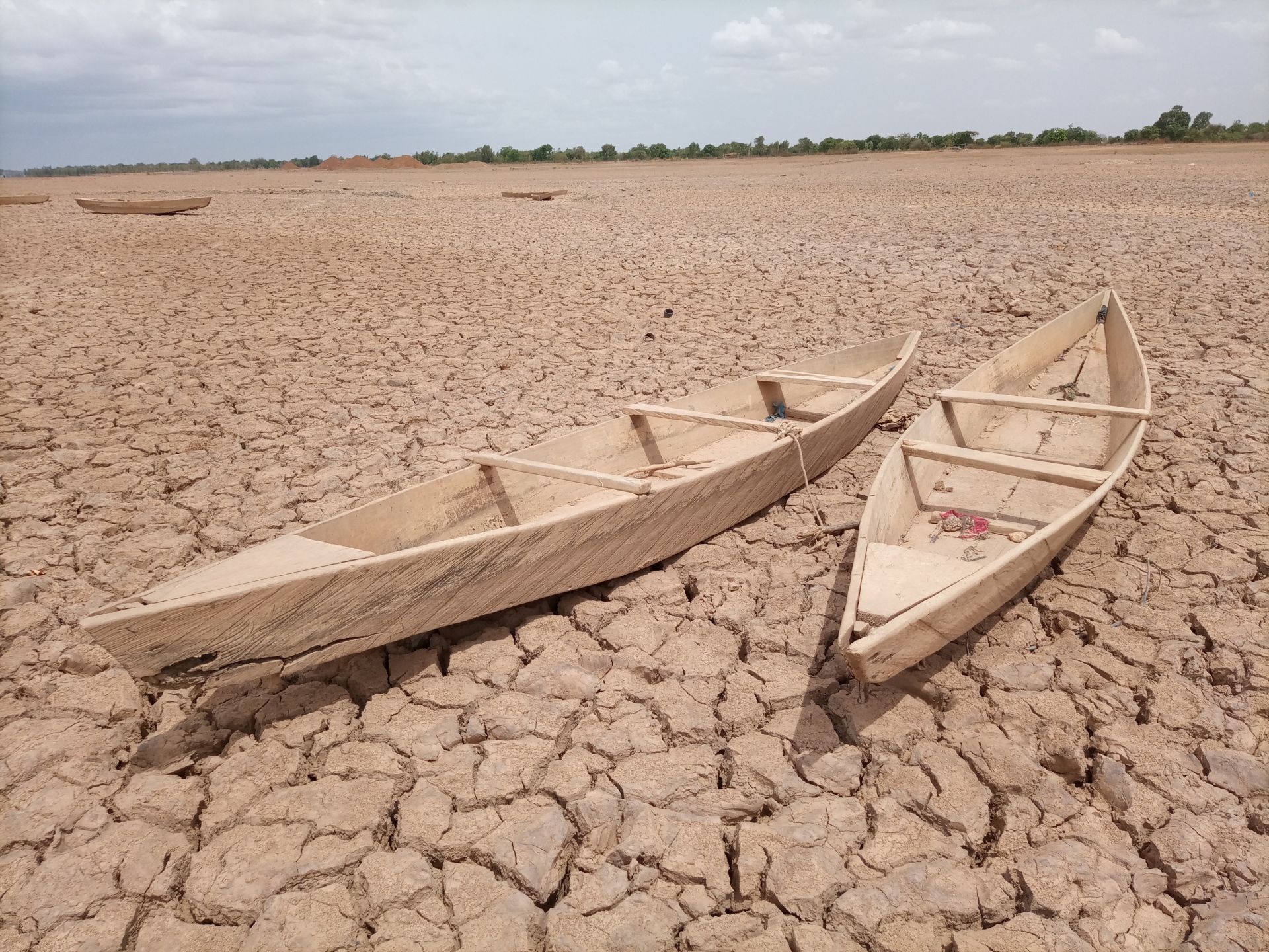
Two – Drought
Drought is familiar in many countries. But its frequency, duration, and intensity constantly increase due to climate change. In 2020, up to 19% of the global land surface was affected by extreme drought – a figure that had never exceeded 13% between 1950 and 1999.
Earth observation makes it possible to constantly observe our planet’s water resources, such as rivers, lakes, and aquifers, by monitoring essential climatological variables such as soil moisture, evapotranspiration, and vegetation. This monitoring can prevent drought, better manage water resources, and protect the environment.
Three – Water quality
The vast majority of fresh waters on Earth is neither potable nor toxic. Still, industrial and commercial activities in our countries cause water pollution, as are agricultural and urban runoff and the discharge of treated and untreated wastewater.
Coastal water quality can be monitored through satellite images that detect the presence of pollutants (eutrophication), and water quality parameters, such as Chlorophyll-a, Sea Surface Temperature, turbidity, and water transparency. This information can help in maritime engineering or national and regional authorities in fulfilling environmental reporting obligations (e.g. Water Framework Directive, Marine Strategy Framework Directive), in environmental remediation projects or ensure that set environmental standards are met and be used, for example, to identify areas where water quality is low and to take measures to improve it.
Four – Studying climate change
Earth observation is a fundamental information source to monitor climate change and its effects on water. For example, satellite data can monitor sea levels and coastal erosion, study rainfall patterns, and help mitigating floodrisk. This information is essential to better understand ongoing environmental changes and develop adaptation strategies.
Five – Agriculture
Finally, agriculture is a significant user of water resources, and optimizing water use in agriculture is critical to managing water scarcity. Satellites can track the water used in agricultural fields, allowing water managers to identify opportunities to reduce water waste and optimize irrigation practices.
These are just some things Earth Observation can do to better understand phenomena, and let us manage water resource more sustainably. Planetek Italia has been processing EO data for about 30 years to help monitor and preserve water and its uses. The goal is to help local governments, utility companies, and all water users in the sustainable management of water resources and water infrastructure, from desalination plants and water and wastewater networks to agriculture, rivers, dams, and coastal waters.
Read on to learn more about the potential of Earth Observation in this field.
Discover more on planetek website’s application page.
Read on: Join “Earth from Space” newsletter on LinkedIn